NASA maps show how fast the SE LA river corridor is sinking

Yikes. The areas with ground water wells are caving. With seas rising, human activity causing the land to depress in such a low area is just scary.
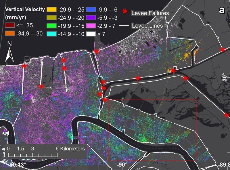
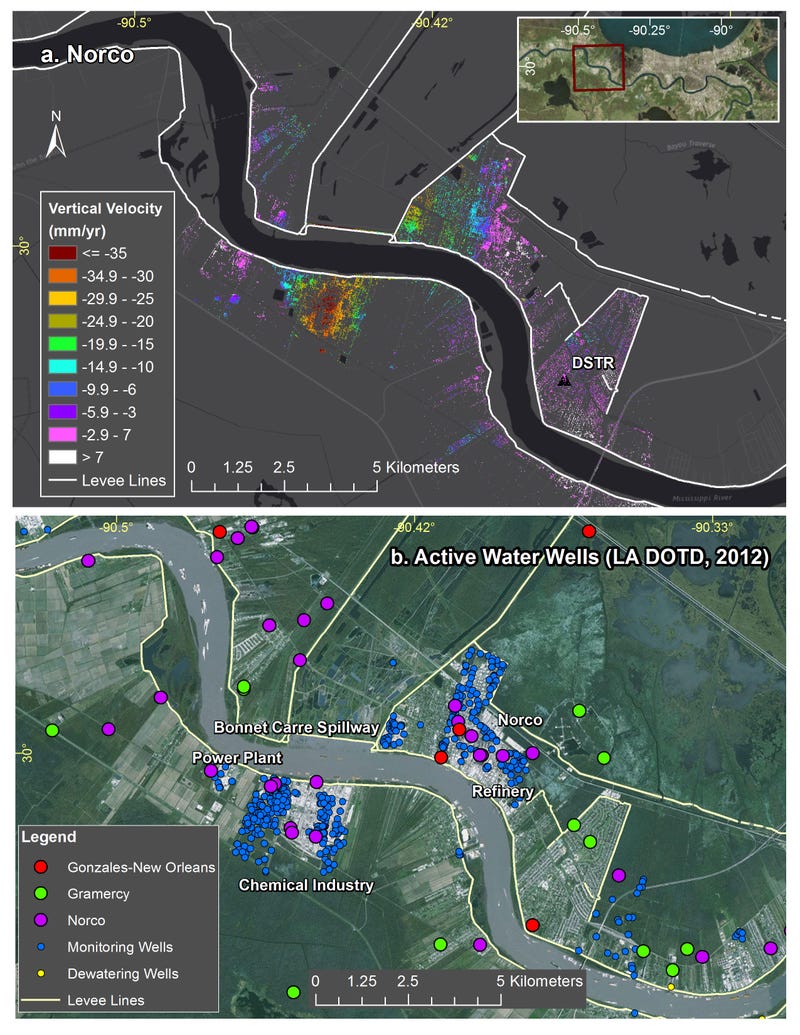
Geologists call this elevation-dropping process “subsidence,” and it’s typically driven by a combination of both natural and human-caused factors. In New Orleans, it’s caused by groundwater pumping and dewatering (i.e. pumping away surface water to prevent standing water and soggy ground).

The most severe sinking was observed upriver along the Mississippi River around major industrial areas, and in Michoud. Both of these areas experience drops of about two inches each year. Other notable drops in elevation were measured in the city’s Upper and Lower 9th Ward, and in Metairie, where the measured ground movements were linked to water levels in the Mississippi River. At Bonnet Carré Spillway east of Norco (the area’s last line of protection against springtime river floods breaching the levees), the scientists detected upwards of 1.6 inches of annual subsidence.


NASA Maps Show How Fast New Orleans Is Sinking