2024 Tropical Weather Thread
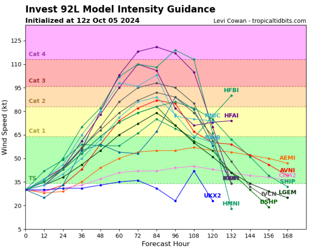
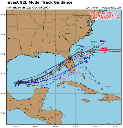
The first is intensity models. With the hurricane models (not shown) being to the high side of intensity guidance the official forecast if the models are consistent would be about 110-115mph hurricane just offshore of Bradenton. The second image is the spaghetti models showing the southern solution is now the outlier. The current satellite images of this thing looks to already be outperforming all guidance. It's too early to tell if this is a head fake or a trend. If it becomes a trend expect intensity guidance to continue to inch higher. Most models have a weakening trend at landfall but the surge wont care about the wind speed.
It takes at least 72 hours to evacuate the Tampa area and the GFS/hurricane models solution makes evacuation of damn near all of Tampa a necessity due to unsurvivable storm surge. Somebody is about to have to make some really difficult decisions without a high level of certainty.

