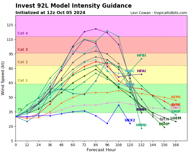
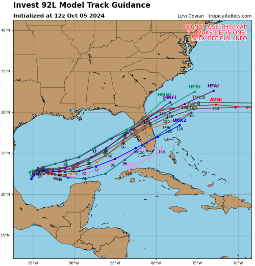
2024 Tropical Weather Thread
Dang - doesn’t look good. My good friend lives in Sarasota, and he said yeah they’re already starting to consider options.
We’re supposed to be flying down from Charleston into Orlando on Thursday evening, heading over to Canaveral for a cruise departure on Friday.
Dang - doesn’t look good. My good friend lives in Sarasota, and he said yeah they’re already starting to consider options.
We’re supposed to be flying down from Charleston into Orlando on Thursday evening, heading over to Canaveral for a cruise departure on Friday.

