2022 Tropical Season thread MERGE (1 Viewer)

What’s the temperature in the gulf now?
We had a fairly mild August with lots of rain - that should dampen some of the intensity fuel it seems
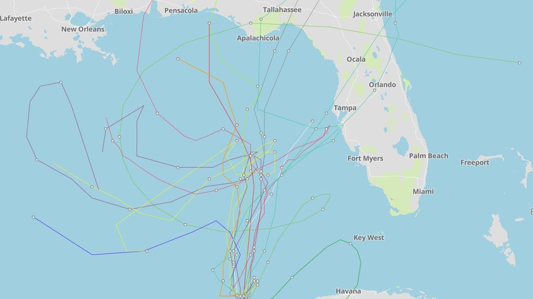
Upper GOM near the coast line a couple hundred miles, plenty warm. A bit above normal. CGOM normal. All said; plenty warm enough for a major.


5AC4C0D6-FFA5-42B7-875D-10CEA9BADED0.jpeg

5AC4C0D6-FFA5-42B7-875D-10CEA9BADED0.jpeg
 
So basically, once again, we're hoping the low arrives just in time to turn it toward the panhandle. If that low doesn't arrive on time to turn it quick enough, we might have a storm curving into us.
 
I hear you but his point was that for this particular storm, the GFS has already shown to be aggressive in the early validation - not just a general opinion of GFS. And based on the model runs, he doesn’t believe the storm will be as intense as early as the GFS has it. And that’s important for the track, as a stronger storm will be more likely to be pulled up the trough over the SE US, whereas a weaker storm will more likely to meander to the west before turning.

He said it’s even possible that if the storm remains on the weaker side, it could just move into Nicaragua. But with these new model runs shifting west, that’s more to where the Euro has been. Its intensity as it moves through the central Caribbean will be very influential on track.
This gets repeated a lot but here's the thing. The models account for this. When people take the parts of the model they don't like and only keep parts of the model they do like then it's just bias.

As for the Euro, it's been farther East and persistently hitting Florida.

The GFS has been the more accurate model since it was overhauled before hurricane season last year but that too is a biased statement. The Euro struggles picking up small tropical systems and most of the tropical systems have been very small the past few years. There is a difference between size and strength.

All the models (except the HWRM which has modeled a 15 mile wide hurricane at times on this system) have been showing a large expansive wind field. So IMO the Euro and GFS should carry pretty similar weight at the moment. The Canadian has a bias where it generates cyclones out of every cloud. That's why many joke that the Canadian (CMC) is called the Can Make Cyclones. However, the systems that do organize the Canadian track is not far off from the GFS and Euro. The ICON is one of the better models out there and I particularly like it when steering currents are weak. The problem with the Icon is it is very accurate 60% of the time and out in left field 40%. Sometimes it's the only model that nails it but even when that happens it looks like it's the 40% outlier so it is very difficult to trust.

The reason there is so much concern is every one of the models mentioned above are forecasting a gulf storm. To add to that concern the ensembles are really tightly clustered that far out and the guidance is pretty tight. The cherry on top is climatological history and storms that form that far South in the Caribbean tend to make a run towards the gulf. It is a very common track. So when you put all of those things together it creates really high confidence levels. However, there is a caveat to that. The farther a model gets away from hour 0 the more it has a bias towards climatological norms because we just aren't that good at forecasting at 5+ days and by adding in climo data it helps the models with accuracy so it can become a chicken or the egg scenario. The closer we get the more accurate the models will be based on the actual fluid dynamics of the atmosphere versus what AI thinks will happen based on climo of the past 55 years. In other words, it becomes more of a reality of current weather patterns versus statistical probability of similar patterns of the past.


That front everyone keeps discussing here could end up being a savior or make this even more catastrophic. If the front doesn't clear the coast and weakens it could set up a Harvey type situation that stalls a big hurricane out right at landfall and dumps a tremendous amount of rain over a large area. If it does clear the northern gulf coast and picks up the storm it could create a Hurricane Charlie situation where the hurricane hits warm water with low shear and the front amplifies upper level venting allowing for RI as it increases speed into Florida. If that were to happen it could cross the state of Florida as a hurricane the entire way and with the large forecast size may slam into the East coast as a major as well. It's also possible the front and the hurricane have a more casual meeting and it helps weaken the hurricane just before landfall like what was supposed to happen with Hurricane Michael. However, it's hard to assume that will happen anymore. It used to happen constantly but just about every hurricane the last 5 years has strengthened into landfall even when it was unlikely to happen. As you can see, there are a million different variables.

Finally, the models are all very consistent with system strengthening at the same place and time because they all have shear dropping off very rapidly just as the system is hitting really warm waters. Some of the intensity guidance really goes nuts with that and has global and hurricane model support. This is where the intensity matters argument becomes a reality. 100 miles matters because it will make a difference how far South the system is but it's anyone's guess and will not have as much of an impact as timing with trough interaction and how far deep the trough goes. This far out we are talking about the dynamics of a hemisphere that can make the difference on whether one city gets hit or another.


This is why the only real advice out there should be get prepared for a likely gulf storm next week and start track watching when it is a hurricane or approaching the gulf. That is when models will start really nailing down a track. All these pro mets trying to call a landfall in a state, let alone an area of a state are full of sheet even if they end up being right. It's fun to say it will hit Florida because statistically it is by far the most likely since it is the closest to the storm, has by far the most coastline and most of the models show landfall headed between Pensacola and Miami.

Anything between Cancun and Florida Keys are in play.
I bet you’re a blast at parties.
 
I bet you’re a blast at parties.
When all these hype posts on social media starts you have no idea what it does to my phone.

This afternoon I got a phone call from someone I went to middle school with freaking out about a possible hurricane hitting their house in 11 days because someone that was a facebook expert on Ukranian military tactics yesterday suddenly knows how to forecast hurricanes better than the National Hurricane Center today. If that call never happened I wouldn't have even remembered they existed.

I'm a captive audience too because I have random numbers calling me all the time to license video so not answering is bad for biz. Then suddenly I'm stuck trying to pretend I care whether or not I remember them, then try to explain to ignore the sheet on facebook only for them to hang up and share the post.
Ugh you have my sympathy. (And of course, I was teasing. - always appreciate your insights here)
 
EURO going out 90 hours has shifted west, along with the ICON (3rd best model from what I understand), closer to the GFS.

No way to tell the intensity, but pretty good consensus the CDO and cloud shield will essentially take up 75% of the GOM. They generally get the size and overall CDO, along with tropical force wind field pretty close, even this far out.

UKMET has been 3rd best for awhile. It nailed Katrina 5 days out. It's only gotten better. This is one model I pay close
attention too.
 
Latest GFS (00Z) shows it hitting just slightly west of New Orleans now. Euro isn't fully updated just yet so I'm not certain where that is forecasting it to go. Still way to early to tell anything, but I did read somewhere that it could end up actually going towards Texas and the GFS trend seems to support that as of right now.
 
Latest GFS (00Z) shows it hitting just slightly west of New Orleans now. Euro isn't fully updated just yet so I'm not certain where that is forecasting it to go. Still way to early to tell anything, but I did read somewhere that it could end up actually going towards Texas and the GFS trend seems to support that as of right now.
The latest model runs have the data in them from a NHC hurricane hunter aircraft mission into 98L. It was NOT a typical reconnaissance mission. It was a survey mission (not sure of the difference). First time I can recall, a survey mission into a tropical wave. The TREND has been more west with the GFS ensembles.

At the end of the day, at this point in time, no way to forecast where and how strong a system this may become. Just keep this in mind. Lots of tropical weather/weather junkies out here, just like there are football fans, or anything similar. Anyone saying it is going to landfall in a GENERAL area right now (no respected met. has yet to even remotely say such), are foolish!!! Just keep watching and watching the trends. Trends are generally a reference to a future OFFICIAL forecast track, when one is formally issued.

This system could also end up a total nothing and die over the Yucatan. Or become a monster over the western tip of Cuba, heading towards the GOM, and heading towards the north. The EURO and GFS, as typical, have a great spread between them at this time.

And as ALWAYS. Follow what the NHC has to say as your official guidance, for your own personal situation.
 
Last edited:
The latest model runs have the data in them from a NHC hurricane hunter aircraft mission into 98L. It was NOT a typical reconnaissance mission. It was a survey mission (not sure of the difference). First time I can recall, a survey mission into a tropical wave. The TREND has been more west with the GFS ensembles.

At the end of the day, at this point in time, no way to forecast where and how strong a system this may become. Just keep this in mind. Lots of tropical weather/weather junkies out here, just like there are football fans, or anything similar. Anyone saying it is going to landfall in a GENERAL area right now (no respected met. has yet to even remotely say such), are foolish!!! Just keep watching and watching the trends. Trends are generally a reference to a future OFFICIAL forecast track, when one is formally issued.

This system could also end up a total nothing and die over the Yucatan. Or become a monster over the western tip of Cuba, heading towards the GOM, and heading towards the north. The EURO and GFS, as typical, have a great spread between them at this time.

And as ALWAYS. Follow what the NHC has to say as your official guidance, for your own personal situation.
Exactly

Please follow the NHC's advice. I just checked in to storm2k. The GFS long range has it sitting of the coast of Se. La..
The Euro still has it hitting the Tampa area. Both of these models will be coming into agreement soon.
 
Ugh you have my sympathy. (And of course, I was teasing. - always appreciate your insights here)
Oh I know you were. Just gave me the chance to rant for a sec. :)

Speaking of parties, there's a reason they are called weather weenies.
 

Create an account or login to comment

You must be a member in order to leave a comment

Create account

Create an account on our community. It's easy!

Log in

Already have an account? Log in here.

Users who are viewing this thread

    Back
    Top Bottom