OP
OP
bclemms
More than 15K posts served!
Offline
I wonder if with even putting out the warnings 2 counties ahead, people still didn't heed it since the storms were so far away. Many people may not have realized the storms were traveling 50+mph is some cases. That will come upon you quickly. It might look decent outside when the warning is issued, then 10 mins later it looks like the world is coming to an end.
From that middle pic, you can get an idea of the rotation. Post a pic of the baseball sized hail you have one.
I didn't do any core punching so I don't have any hail pics. The only hail we saw was on the ground when trying to catch up to the storm after crossing the river north of Greenville. It was about the size of ping pong balls and had been on the ground for about ten minutes before we got on it.
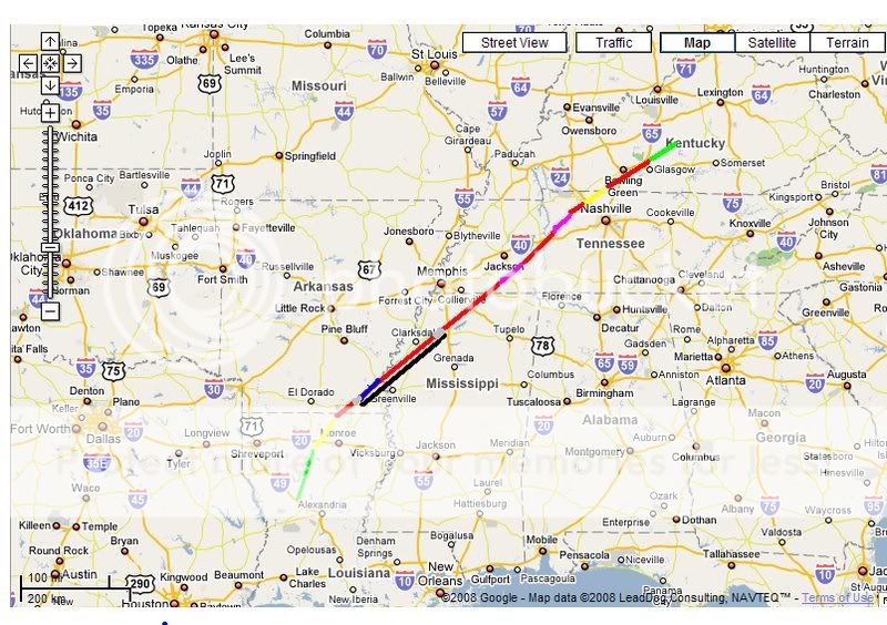
After dark the storms were moving even faster. The mobile threat net I use had several moving over 80mph including this one when it got towards central Ms. I was going 90 for 30 minutes and lost ground on the storm north of Cleveland, Ms. The storm that put a tornado down in Oxford, Ms went from Batesville, Ms to Nashville in just over 3 hours.
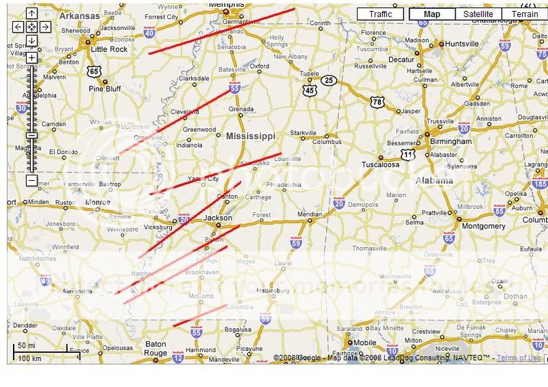
I'm not sure if you are familiar with Baron's Mobile Threat Net but it is a program that uses XM radio to send radar, satellite, warnings, watches, shear and other products to a receiver that plugs into the USB port on a computer. The software has GPS mapping with the radar over the top so you can see your postion compared to the storm. It updates every 5 minutes. Last night coming home through the Delta some of the storms in front of the line would be ten miles to our West and before the next radar frame the storm would overtake us. These were some of the most intense thunderstorm winds I have been in. I'm sure there was some extensive wind damage last night that is not being talked about because they are overshadowed by the tornadoes.