Severe Weather outbreak today and tomorrow (2 Viewers)

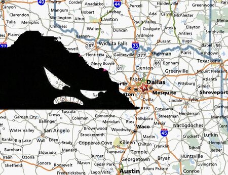
Based on the satellite, Abilene should no longer exist
 
The satellite image is not promising
 

Attachments

  • satellite.JPG
    satellite.JPG
    82.7 KB · Views: 3
Heh. That tornadic cell that past ABI is heading westward instead of north. Looks like a classic right-turning supercell storm. I'm hoping the showers moving through DFW right now will help to somewhat stabilize the atmosphere before those big supercells get going.

BTW, today is normally the day of the week when the tornado sirens are tested. Unless severe weather is in the area. If you hear one of the sirens today, it will not be a test. Run like heck and grab the video camera.
 
Also, I hope there's nothing you want to watch on network TV tonight because it will most likely be wall-to-wall weather coverage.
 
I have a horrible feeling that we will see major destruction in Breckinridge, Tx. That cell looks very nasty and is passing directly through the town. Hopefully it is as small as I imagine it would be and nobody is killed.
 
Yeah, that storm looks very nasty.

520 PM CDT WED APR 9 2008

...TORNADO EMERGENCY FOR STEPHENS COUNTY AND THE CITY OF
BRECKENRIDGE...

AT 520 PM CDT...A LARGE...VIOLENT TORNADO WAS ON THE GROUND JUST
SOUTH OF BRECKENRIDGE...MOVING EAST AT 31 MPH.

PEOPLE IN AND JUST SOUTH OF BRECKENRIDGE SHOULD BE IN SHELTER
IMMEDIATELY! THIS IS A LIFE-THREATENING SITUATION.
 
Didn't even see that. Was busy working and hit the wrong tab by accident and just happened to have had the radar zoomed in on velocity scan over Breckinridge. Then looked at the radar and could see the debris notch that is only seen on the truely violent tornadoes like Moore, OK and Greensburg, Ks.
 
That cell does look ugly on radar. Hope everyone took shelter there.

I've got lots of friends from all over the U.S. in Irving TX for the Dachshund National dog show this week...my old friends from NJ are sure not used to this! I'm glad I'm not headed up there until early Friday.
 
It appears it will pass south of Breckenridge. Long night ahead.
 
It appears it will pass south of Breckenridge. Long night ahead.

Yep, I don't know if you remember the Greensburg Tornado but it looked almost identical to this one except the hook dropped south and hit the town of Greensburg just when it looked like the tornado would pass to the north. This one looked like it was going to clear out Breckenridge then the hook dropped just south hopefully missing the town.
 
No, I don't remember that one. Radar is indicating an new tornado may be forming east of where the present circulation is.
 
No, I don't remember that one. Radar is indicating an new tornado may be forming east of where the present circulation is.

here it is
<object width="425" height="355"><param name="movie" value="http://www.youtube.com/v/t2LEj1zhsso&hl=en"></param><param name="wmode" value="transparent"></param><embed src="http://www.youtube.com/v/t2LEj1zhsso&hl=en" type="application/x-shockwave-flash" wmode="transparent" width="425" height="355"></embed></object>
 
Hopefully the grunge popping up in front will help to cut off the inflow but it is pretty unlikely at this point. Still a ways off but Denton, Tx looks like it could take a major hit and if it continues to turn right it may hit farther south in the Plano to Lewisville area. Hopefully it weakens or goes farther north because if this thing rolls through the north side of the Dallas metro it could be devistating. I already called and warned my brother in Plano and I would suggest anyone else that knows people on the north side of Dallas to go ahead and give them a heads up call because it may be hard to get through if the storm approaches the metro. I'm sure the local stations are going wall to wall on this cell right now and will have video of the tornado up shortly.
 
Got this from a guy on another forum.

damage report from NWS chat room: 183 South... south of town, lots of damage, power lines down.... traffic lights in town not working, large trees uprooted... confirming 18-wheeler blocking road with TXDOT trying to clean it up.... fires due to lightning strikes... reporting multiple structural damage reports.... that's from our reporter in Breckenridge FWD
 

Create an account or login to comment

You must be a member in order to leave a comment

Create account

Create an account on our community. It's easy!

Log in

Already have an account? Log in here.

Users who are viewing this thread

    Back
    Top Bottom