Severe Weather Saturday, potentially violent tornadoes (1 Viewer)

bclemms

More than 15K posts served!
Joined
Jul 16, 2005
Messages
37,401
Reaction score
54,806
Age
16
Location
Jackson, ms
Offline
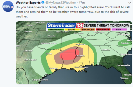
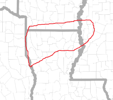
Just a heads up for anyone in East Tx to central Ms and southern Arkansas and areas south. Very potent weather system will move over the area starting as Saturday morning. Conditions are looking quite prime for tornadoes with the possibility of violent tornadoes.

I will update as the fine details get worked out but it is a good time to plan accordingly.
 
To me, any tornado is classified as a violent tornado. I don't want any part of a tornado, violent or otherwise.
 
River Ridge had a tornado Sunday. Knocked down power lines and trees.
 
To me, any tornado is classified as a violent tornado. I don't want any part of a tornado, violent or otherwise.
EF0 tornado is usually brief, narrow and may uproot a few trees or take some shingles off a house.
High end violent tornadoes can be over a mile wide, travel hundreds of miles and rip everything off the ground including the road.

There is an incredible difference which is why I wish the NWS would quit warning so many storms that have little chance of producing or may produce a very brief, weak tornado. Chicken little and all.
 
I am in North Mississippi in my motorhome at a COE campground. I was to drive to Little Rock on Saturday, but I decided to stay here until Sunday where I did not have to drive in the storms.
 
Just a heads up for anyone in East Tx to central Ms and southern Arkansas and areas south. Very potent weather system will move over the area starting as Saturday morning. Conditions are looking quite prime for tornadoes with the possibility of violent tornadoes.

I will update as the fine details get worked out but it is a good time to plan accordingly.
Been seeing this one build for a few days, and each day they seem to be warning a larger area. Looks like it could be rough.
 
@bclemms So where will you be chasing at tomorrow?
 
If you are staying in the camper have a backup plan because that is probably the worst place to be and you guys will see storms after dark.


Not sure where I'll be just yet. Probably somewhere near Shreveport to start then work my way back East. As for the SPC moderate risk, wouldn't be surprised at all to see that upgraded to high risk once the models shake out. Most likely going to stay in this area until after dark then will be back over in central Ms.
113947
 
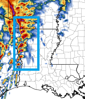
The most reliable high resolution model has a line of Supercells from far SW Arkansas to north of Lake Charles. If this were to happen, just about every one of those cells would likely be producing a tornado with a couple likely violent. It's just one of a dozen scenarios how this will play out. This particular model gets far more accurate as we get closer to the event and will likely dial in about 8 hours before things get bad.
113948
 

Create an account or login to comment

You must be a member in order to leave a comment

Create account

Create an account on our community. It's easy!

Log in

Already have an account? Log in here.

Users who are viewing this thread

    Back
    Top Bottom