***TROPICAL ALERT** Tropical Storm BARRY (previously 92L) (4 Viewers)

I’m sorry if I upset anyone. I’m stressing out right now. I can’t afford to lose work time at my business. It is all I’ve got. The last thing I need is to be flooded out or have damage to my valuables. I’ll shut it down here. Hoping for the best.
Apparently you went too whatever and got banned. I am in the exact same position as you but I realize I can't ******** change the weather or predict the future. I am praying UPS is open tomorrow but I am preparing for the worst now. If I flood it would force me to give up my dream and look for a job. We will persevere. We always have and we always will.
 
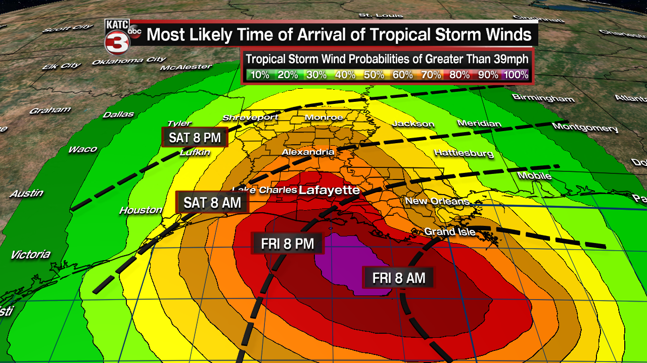
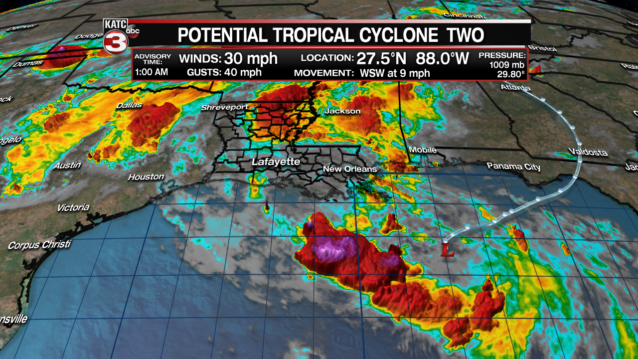
Latest tropical graphics, including wind, surge, rain and forecast timeline for Acadiana

Posted: 9:36 PM, Jul 10, 2019

Updated: 12:46 AM, Jul 11, 2019

90


By: Rob Perillo | KATC

90


The potential tropical system in the Northern Gulf of Mexico appeared to be getting organized Wednesday evening with a burst of convection near and to the southwest of the center of the system as identified by the National Hurricane Center (NHC).

Potential Tropical Cyclone 2 was very close to becoming a tropical depression as of the 10pm Wednesday forecast advisory.

h1.png


The system is still expected to gradually become a tropical storm Thursday with an initial southwestward motion turning westerly Thursday and then northwesterly toward the Acadiana Coast Friday into Saturday.

Full Article - KATC

Rob is a very good local meteorologist.
 
GFS has clearly moved east now, with practically a direct hit on NOLA at this point.
 
The trend is east. A trough in the upper midwest is helping to break down the eastern lobe of the ridge, that will ultimately help steer Barry.
 
Looks a bit ragged in the upper levels this am. It is doing pretty much what the NHC has forecasted. Some dry air has been entrained overnight. But as the NHC has been forecasting, it was not supposed to ramp up to TD, or TS status, until today. We’ll see how it plays out soon enough. Stay advised.

Latest track takes it onshore through Terrobonne bay, heading between Lafayette and Baton Rouge, but just a tad west of Baton Rouge. Landfall not until the early morning hours of Saturday as a minimum Category 1 Hurricane.

As of right now, the top winds I see are 25 mph.
 
Last edited:
I'm a bit surprised that this storm isn't more organized. We have been listening to nearly a week of weather reports describing how favorable the conditions would be for development once the low moved over water. But it seems that everyone is still scouring the Gulf looking for a center of surface rotation.

While I still believe it will get it's act together by landfall, it's a good thing that it didn't do so right from the start because it's been over very warm water for nearly two days now. Sadly all it's going to take to be a destructive storm is if it brings heavy rains to the already swollen waterways.

The full story has yet to be written.
 
I'm confused. Just went to Algiers where the levee is only at 19'. No evacuations there, corps arent sandbagging and river projections are still calling for overtopping. Top 4' or so of the levee is eartgen built so it would wash that out if overtopped. Current river level is well above the neighborhoods below the levee. So what gives? Are they not believing their own projections? Are they going to wait until last minute? Kind of odd. I don't think the river will back up that much but I wouldnt want to be the person responsible if it did.
 
I'm confused. Just went to Algiers where the levee is only at 19'. No evacuations there, corps arent sandbagging and river projections are still calling for overtopping. Top 4' or so of the levee is eartgen built so it would wash that out if overtopped. Current river level is well above the neighborhoods below the levee. So what gives? Are they not believing their own projections? Are they going to wait until last minute? Kind of odd. I don't think the river will back up that much but I wouldnt want to be the person responsible if it did.
well...that sucks
supposedly algiers point is one of the higher elevations in the city (17' maybe), but if the levee overtops around the chalmette ferry, the river seems like it would just become a battering ram and knock out parts of the levee and that water makes a beeline for the point
 
The following is from a pro met at storm2k
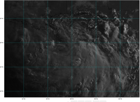
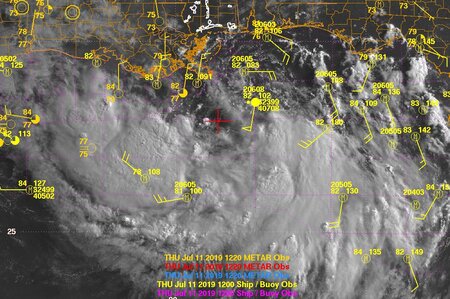
Here's a sat pic with surface obs. Can see the center where the red crosshairs are. That's where recon found it, though it's not well-defined yet. Farther north center means farther east landfall. Might miss Vermilion Bay to the east.
 

Attachments

  • waxman.jpg
    waxman.jpg
    214.6 KB · Views: 25
The following is from a pro met at storm2k
Here's a sat pic with surface obs. Can see the center where the red crosshairs are. That's where recon found it, though it's not well-defined yet. Farther north center means farther east landfall. Might miss Vermilion Bay to the east.

damn near due south of Mouth of Miss River.

At least the N/NE side is all but non existent. I would imagine landfall now more tomorrow than Sat?
 

Create an account or login to comment

You must be a member in order to leave a comment

Create account

Create an account on our community. It's easy!

Log in

Already have an account? Log in here.

Users who are viewing this thread

    Back
    Top Bottom