- Admin
- #1
Offline
FYI. Looks like low chance to develop, but when it hits the Carolinas, the GFS and Euro have shown development and zipping up the East Coast.
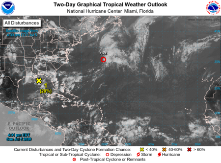
ZCZC MIATWOAT ALL
TTAA00 KNHC DDHHMM
Tropical Weather Outlook
NWS National Hurricane Center Miami FL
200 PM EDT Sun Jul 5 2020
For the North Atlantic...Caribbean Sea and the Gulf of Mexico:
The National Hurricane Center is issuing advisories on Tropical
Depression Five, located a few hundred miles northeast of Bermuda.
1. Recent satellite and radar observations indicate that a small low
pressure system has formed within a broader area of low pressure
near the northern Gulf Coast. The low is producing a few showers
near its center, and some slight development is possible before it
moves inland early Monday. The broader low pressure system is
forecast to move northeastward and could emerge offshore of the
Carolinas later this week, where environmental conditions are
expected to be more conducive for development.
* Formation chance through 48 hours...low...20 percent.
* Formation chance through 5 days...medium...40 percent.
Forecaster Zelinsky
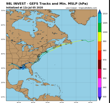
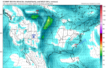
I drew it off shore, but it pretty much was on the coast.

ZCZC MIATWOAT ALL
TTAA00 KNHC DDHHMM
Tropical Weather Outlook
NWS National Hurricane Center Miami FL
200 PM EDT Sun Jul 5 2020
For the North Atlantic...Caribbean Sea and the Gulf of Mexico:
The National Hurricane Center is issuing advisories on Tropical
Depression Five, located a few hundred miles northeast of Bermuda.
1. Recent satellite and radar observations indicate that a small low
pressure system has formed within a broader area of low pressure
near the northern Gulf Coast. The low is producing a few showers
near its center, and some slight development is possible before it
moves inland early Monday. The broader low pressure system is
forecast to move northeastward and could emerge offshore of the
Carolinas later this week, where environmental conditions are
expected to be more conducive for development.
* Formation chance through 48 hours...low...20 percent.
* Formation chance through 5 days...medium...40 percent.
Forecaster Zelinsky


I drew it off shore, but it pretty much was on the coast.


