Yo Bulldawg is it snowing up their where you live (1 Viewer)

Saintman2884

Hall-of-Famer
Joined
Dec 17, 2003
Messages
17,426
Reaction score
5,081
Offline
I was watching the Weather Channel just now and I started thinking almost immediately about Anniston and you, Bulldawg. I knew you lived up their and I wanted to give you a shout out to the snow flurries in your area maybe.

Meanwhile its very cold here in Mobile, their is a cold damp rain in West Mobile our where I live, the forecasters said we may drop down to the low 20's this weekend. but alas, it will not snow. I wish it would though.

but Bull, look out for some snow in your area, you may get a lot of it rest of today and tonight in Anniston and in the Huntsville are as well
 
Do you think Auburn will get some snow, Maxp? I have some buddies up in that area that say you might. But then again, they've been wrong before.

Be careful anyway up their in the sleet and snow if it does happen.
 
Well, Anniston is under a Winter Weather Advisory which usually means Sleet and/or freezing rain. You can certainly see snow as well, but with the WWA his NWS is expecting more of the nasty ice than snow.
 
Do you think Auburn will get some snow, Maxp? I have some buddies up in that area that say you might. But then again, they've been wrong before.

Be careful anyway up their in the sleet and snow if it does happen.

No, it's not cold enough. Probably more rain/sleet mix.
 
It started snowing here about 1. Right now it's back to rain, but the snow line isn't far off. In fact, some places that are showing rain on radar is really getting hammered with snow (Carrollton, GA for instance). We'll probably get a bit more snow/sleet tonight as the temps cool, but it should be back to all rain by 9 PM.
 
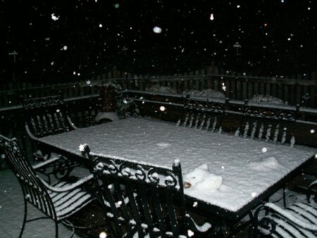
Bull, would you mind putting up some pictures on the EE board of the snow if you can get some. I don't want to sound silly but I like looking at pictures of icy precipitation from time to time when the occasion fits it. If you don't want too, that would be okay by me too. I don't want to inconvenience you you know
 
ice.jpg
 
Bull, would you mind putting up some pictures on the EE board of the snow if you can get some. I don't want to sound silly but I like looking at pictures of icy precipitation from time to time when the occasion fits it. If you don't want too, that would be okay by me too. I don't want to inconvenience you you know
Nothing to see right now. The ground is too warm and with the changeover to rain anything that was sticking has been washed away. But if it starts back up tonight I'll try to get some pictures.
 
Where do you live V? Everything tapered off here during the afternoon. But they're calling for another shot of snow Friday night/Sat morning with temps dropping into the teens as early as 7PM Saturday.
 
BD, here's an update from James Spann's Blog.

http://www.alabamawx.com/

January 17, 2008, 10:13 am | James Spann | Forecast Discussion
Based on the volume of data we have seen this morning, here is our preliminary thinking. Lets cut through all this model mumbo-jumbo and get down to it.
FRIDAY NIGHT: Rain should move into the state between 6:00 p.m. and 12:00 midnight Friday night. The rain should change to snow in the 10:00 p.m. to 2:00 a.m. time frame as the Arctic air dives southward.
SATURDAY: Snow should be widespread across the central part of Alabama from 3:00 a.m. until 12:00 noon. Most likely, there will be about a 50 mile wide band of heavy snow, with potential for 3 to 6 inches. First guess is that the center of the axis of heavier snow will be from roughly Livingston to Clanton to Roanoke. There will be potential of 1 to 3 inches of snow on either side of that heavier snow band. By the time you get to the Tennessee Valley, snow should be light and spotty.
For the I-20 corridor, this looks like a 2 to 4 inch kind of snow… for places like Tuscaloosa, Birmingham, and Anniston. Snow should accumulate as far south as Montgomery, and a few snow flakes could be found before the day is done deep into South Alabama.
NOTES: We are talking all snow here, NOT freezing rain (no ice storm). Freezing rain events are the ones that usually mean power outages, not snow events. The snow has to be extremely wet and heavy for widespread power outages. Can’t rule it out, but again, this is not ice. Just snow.
Travel problems could be very significant Saturday morning, unlike yesterday’s event with temperature above freezing when there were very few ice issues.
THIS IS PRELIMINARY. The snow amounts and placement could change. I will have an update by 3:30 when the regular afternoon discussion and Weather Xtreme video is posted. Stay tuned.
 
Well if James Spann is calling for 2-4 inches, we'll either get a foot or nothing at all.
 
Yeah, that's how it is here too. Forecasting wintry precip seems to be hit or miss. I've seen forecasts for multi-inch snows turn out to be rain, and light rain forecasts turn out to be sleet and snow. Us lower-latituders just take what we get when we see it falling from the sky. ;)
 

Create an account or login to comment

You must be a member in order to leave a comment

Create account

Create an account on our community. It's easy!

Log in

Already have an account? Log in here.

Users who are viewing this thread

    Back
    Top Bottom