Potential Severe Weather tomorrow, 3-22-22 (Update: Tornadoes on ground in metro area) (2 Viewers)

Wind profiles were highly favorable for heavy rain and flooding. Parameter space was high but Meridional flow (South to north mid level flow) leads to slow moving squal lines and brief QLCS tornadoes. It’s pretty much the same setup that SPC always goes overboard with and end up with a busted forecast.
Thank you for the explanation. I am envious of your weather knowledge.
 
Seems like they said possible tornado on the Westbank!
 
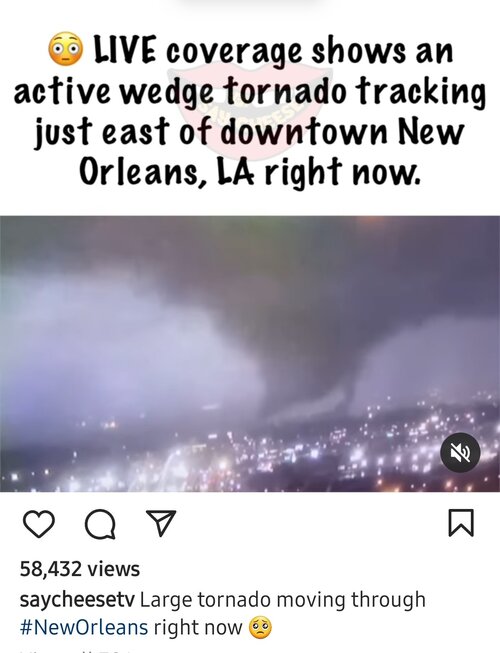
WDSU is showing live video of a tornado that just crossed the river into arabi and is heading northeast
 
Can someone confirm this
 

Attachments

  • Screenshot_20220322-210152_Instagram.jpg
    Screenshot_20220322-210152_Instagram.jpg
    158.5 KB · Views: 4

It's heading to Slidell and Pearl River now.
 
Threat wasn't overstated.

Hope everyone is okay.
Crazy thing is that New Orleans was in "only" a level 3 out of 5 on SPC's scale. My area today that got no tornadoes was a level 4. You just never know.

And there are videos all over Twitter for this. All monstrous.


NSFW language:
 
Crazy thing is that New Orleans was in "only" a level 3 out of 5 on SPC's scale. My area today that got no tornadoes was a level 4. You just never know.

And there are videos all over Twitter for this. All monstrous.


NSFW language:


I know man. I have to explain this to people every day when we put out a forecast. A guy asked me if the threat we have coming through tonight is as bad as what went through last Friday (FL Panhandle), he said it wasn't bad last week. I'm like dude, we forecast for the base and there was a tornado 10 miles away.
 

Create an account or login to comment

You must be a member in order to leave a comment

Create account

Create an account on our community. It's easy!

Log in

Already have an account? Log in here.

Users who are viewing this thread

    Back
    Top Bottom