2024 Tropical Weather Thread (3 Viewers)

I hope all these people that bought Generators know how to use it and take care of it. I’m watching the Jefferson Parish presser . Sounds like it was a problem for IDA
I just got a propane one this year. Looking forward to not having to deal with gasoline ones ever again.
 
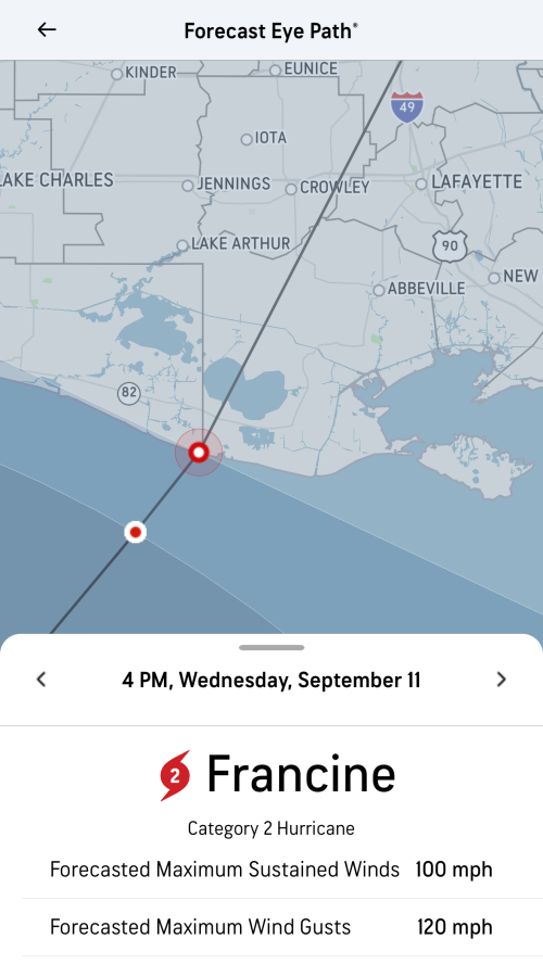
WLOX said Cat 2 100mph by Wednesday.
Honestly, I wouldn't be surprised to see it reach 3 tomorrow evening before being knocked down to a 2 before landfall. But it should move on through without getting stuck, so Wednesday evening will suck, but it'll be over in a matter of hours hopefully.
 
Everyone agrees Cat 2 now. Interesting. There is one track that wanted no part in this and goes all the way to Tallahassee.
 
I mean, there's no way to forecast the eye path that precisely at 48 hours out. That's why there's a cone.
 
I mean, there's no way to forecast the eye path that precisely at 48 hours out. That's why there's a cone.

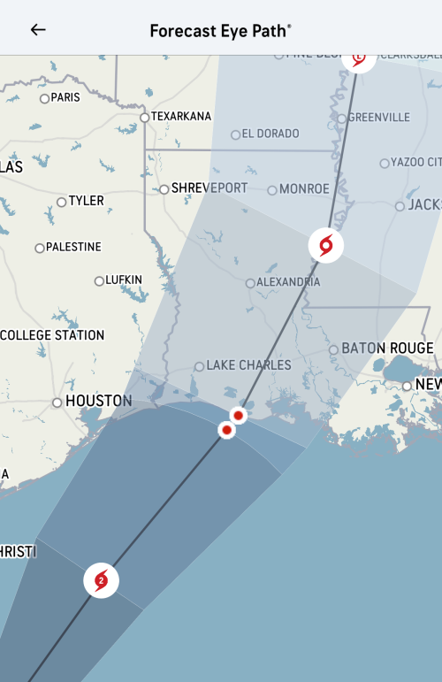
Here’s the cone if you zoom out - and I don’t think it’s supposed to be a landfall forecast except to the extent that if the cone is the cone, the center line of the cone is statistically significant. But we all know that’s not really a thing at this point in a forecast. The name is misleading (probably intentionally, the bastages).

What it’s most useful for, IMO, is tracking changes from one cone to the next - you can easily visualize the adjustment based on where this line moves.


1725929659352.png
 
I mean, there's no way to forecast the eye path that precisely at 48 hours out. That's why there's a cone.

Well if you want to bet the long shot. Bet the one going east of Pensacola

francine-model-66df16456141e.jpg


You look at that and say why wouldn’t it just go to Brownsville. It’s like only 200 miles away . Nope it wants to take the long way to land.
 
Rofl, 3 out of the 4 gas stations I went to were washed out of gas around 7:30pm. Might go uber early tomorrow morning and try to cap off my tank, its at half a tank atm.
 
Looking really ragged at the moment from dry air. It should start turning East soon and get in more favorable conditions to develop. The farther East move looks less likely with the NW jog today. Models have been really consistent. I’ll start believing them more tomorrow when the turn is made and it gets that inner core structure back.
 

Create an account or login to comment

You must be a member in order to leave a comment

Create account

Create an account on our community. It's easy!

Log in

Already have an account? Log in here.

Users who are viewing this thread

    Back
    Top Bottom